Phoenix Nest
Map of Northern Europe — Dahlbergh
Map of Northern Europe — Dahlbergh
Regular price
$750.00 AUD
Regular price
Sale price
$750.00 AUD
Couldn't load pickup availability
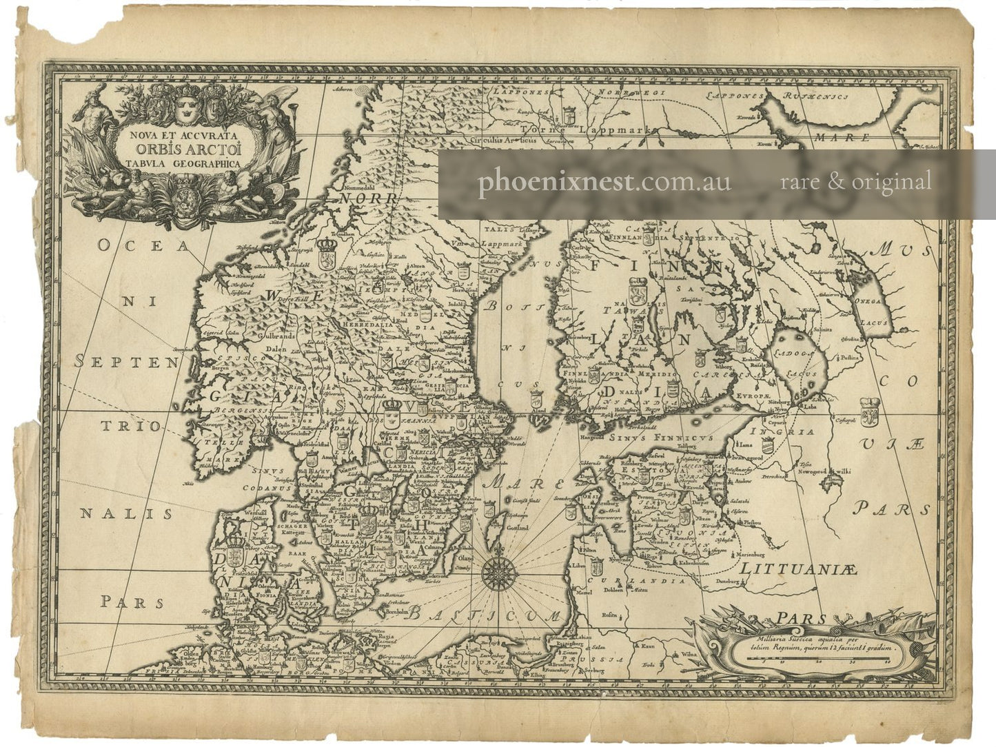
A magnificent late seventeenth-century map offering a detailed geographical survey of Northern Europe, including Scandinavia and the Baltic Sea region.
Original title: Nova et Accurata Orbis Arctoi Tabula Geographica. Compiled by Erik Dahlbergh. From Suecia Antiqua et Hodierna. Published in Stockholm, c. 1700.
Erik Dahlbergh's monumental Suecia Antiqua et Hodierna was an ambitious project to document the Swedish Empire's topography and architecture, serving as both a historical record and a testament to its power. This general map provides the geographical framework for the topographical and architectural plates that follow.
Copperplate engraving. Sheet size not measured. Good.
Artwork Details
| Type | Architectural print |
|---|---|
| Artist | Erik Dahlbergh |
| Date | 1700 |
| Period | 17th century |
| Medium | Copperplate engraving |
| Origin | Sweden |
| Publication | Suecia Antiqua et Hodierna |
| Subject | Coastal & Marine, Waterway |
| Condition | Good |

More from 1660-1715 Ancient and Modern Sweden
-
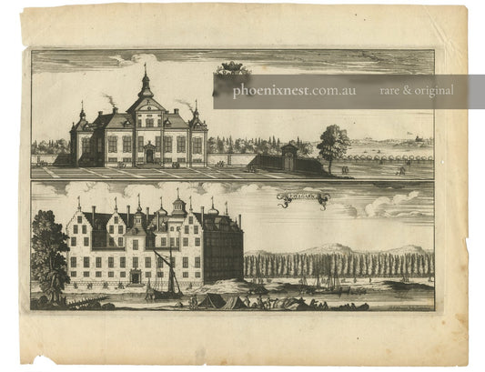
Steenhammar and Tullgarn Castles — Aveelen
Regular price $650.00 AUDRegular price -
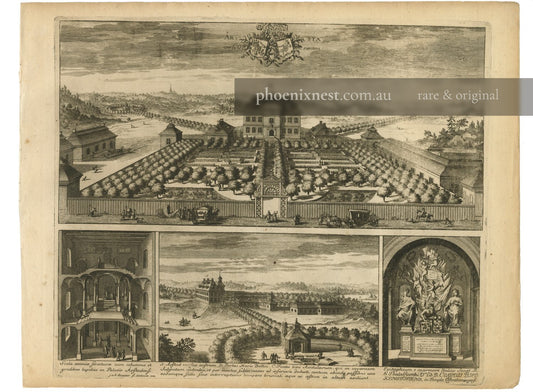
Årsta Manor, Sweden — Aveelen
Regular price $850.00 AUDRegular price -
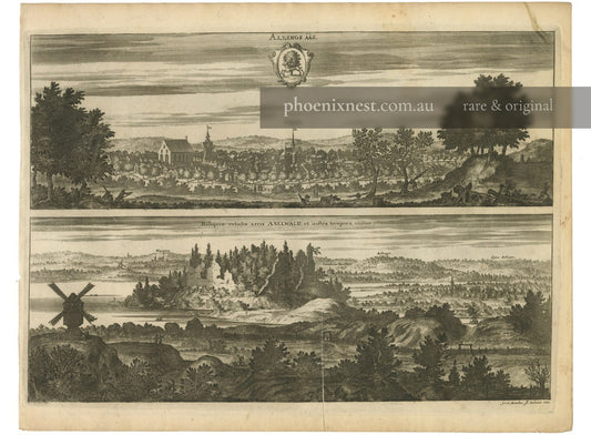
Alingsås and Axevalla Castle — Sandrart
Regular price $650.00 AUDRegular price -
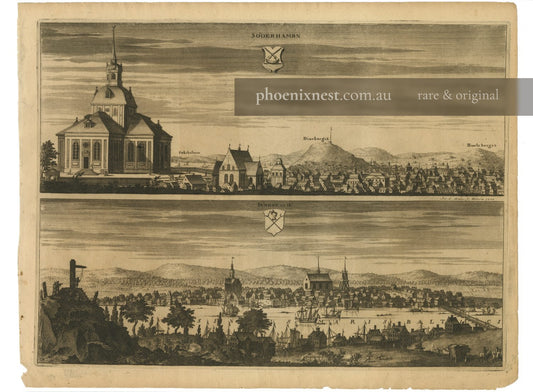
Söderhamn and Sundsvall — Suecia Antiqua
Regular price $600.00 AUDRegular price