Phoenix Nest
Troy in Småland, Urshult Parish — Rudbeck
Troy in Småland, Urshult Parish — Rudbeck
Regular price
$1,200.00 AUD
Regular price
Sale price
$1,200.00 AUD
Couldn't load pickup availability
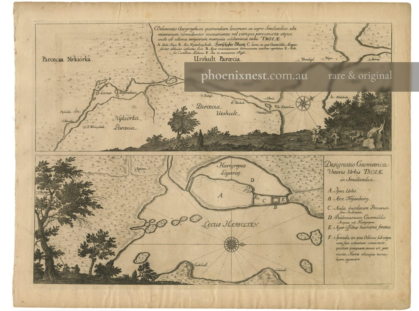
An extraordinary 17th-century map from Olof Rudbeck's controversial Atlantica, illustrating the supposed site of ancient Troy in Småland, Sweden.
Drawn and engraved by Olof Rudbeck the Elder. From Atland eller Manheim (Atlantica), Volume I. Published in Uppsala, 1679.
Rudbeck's monumental but pseudoscientific work argued that Sweden was the original Atlantis and the cradle of Western civilisation. This map, depicting Lake Håfveltan and surrounding parishes, was central to his theory of Troy's Swedish location, blending historical geography with speculative archaeology.
Copperplate engraving. Sheet size approximately 40.0 × 50.0 cm. Very Good.
Artwork Details
| Type | Architectural print |
|---|---|
| Artist | Olof Rudbeck the Elder |
| Date | 1679 |
| Period | 17th century |
| Medium | Copperplate engraving |
| Origin | Sweden |
| Publication | Atland eller Manheim |
| Subject | Ruins & Antiquities, Waterway, Architecture |
| Condition | Very Good |
| Dimensions | 40.0 × 50.0 cm |

More from 1660-1715 Ancient and Modern Sweden
-
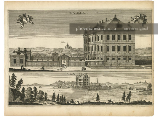
Sävstaholm and Sjöö Castles — Dahlbergh
Regular price $550.00 AUDRegular price -
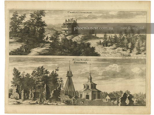
Charlottenburgh and Vreta Abbey, Motala — Aveelen
Regular price $350.00 AUDRegular price -
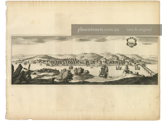
Hernösand — Dahlbergh
Regular price $450.00 AUDRegular price -
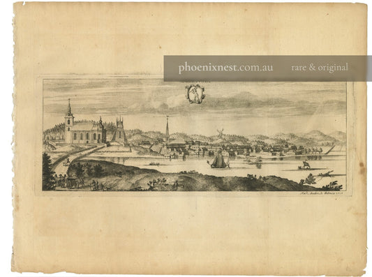
Askersund — Dahlbergh & Baden
Regular price $650.00 AUDRegular price